Argyle Tiles — add a satellite layer to your app's map
Last week I began publicly launching Argyle Tiles, and it's been getting closer to beta nearly every day since.
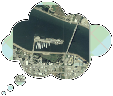
I'm gradually gathering as much good-looking aerial and satellite imagery as I can, and turning it into tiles for those "slippy maps" you see in more and more web/mobile apps these days. There are several great ways to turn OSM data into custom-themed street maps, but sometimes a product needs visual imagery too. That's a lot of data to host and keep improving just for one app.
It's challenging, but I'm pressing forward because it feels like somebody should. I'll need to find enough other developers/companies who are willing to share in the costs to make this sustainable, but the nice thing about building out global tile coverage is I can start "lo-fi" and grow with whatever budget the service can earn.
Argyle Tiles won't be hiring a fleet of airplanes to turn the entire globe into a high-resolution 3D facsimile of itself, or sending an army of expensive camera backpacks to far away places, any time soon. Maybe someday, but we've gotta start somewhere. For my part, I intend to make and keep this service as truly open as possible. I really want for a map tile downloaded from our server to be yours: to keep, to remix, or I guess even to resell if you must.
For now I'll be starting with existing public domain data. Even that will take some time and revenue to build out fully (and beautifully), but I'll at least be able to offer basic global coverage at relatively low resolution, and full coverage of the United States at pretty amazing detail. If you or a company you know (or hey, even just an app you use!) needs a "satellite" base in their map but their product doesn't fit contractually or philosophically within the restrictions of the bigger commercial providers, please let me know.